
 Summer will soon be here, the time of vacations and vacations, of which, of course, trips around the Czech/Slovak Republic and trips abroad are an integral part. And if there isn't a plane or a bus booked, the next step is a car whose driver is tasked with getting the traveler to the planned destination. But what should he do if he can't orient himself on a paper map and his GPS navigation built into the car is in Hungarian? At that moment, the well-known GPS Navigator application from the MapFactor developer studio comes into play, which is available in the Czech Republic and can be used to travel not only throughout Europe, but perhaps even the entire world!
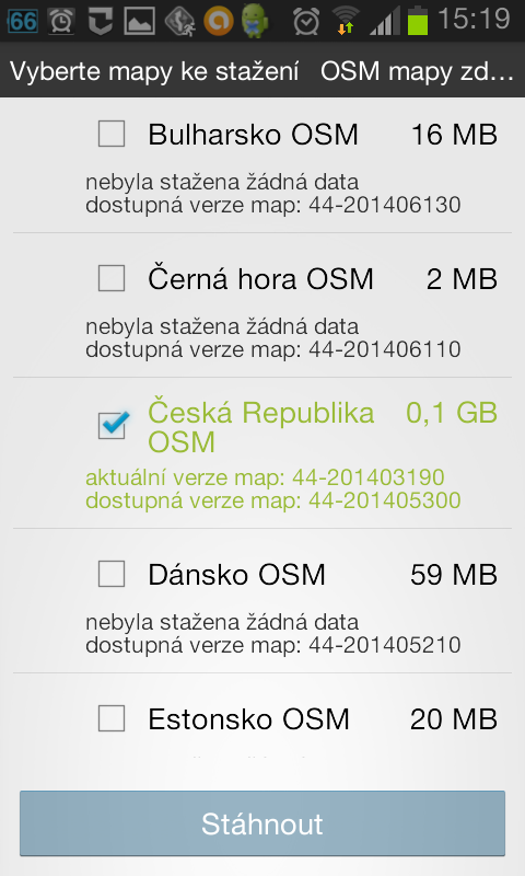
The navigation can be downloaded for free from Google Play under the name Mapfactor: GPS Navigation and immediately after installation and the first start, the user is asked whether he wishes to use the FREE version or to purchase paid TomTom maps. However, the free version will be more than enough for most motorists, as it is also quite sophisticated with eight maps. After that, it is necessary to download maps with the help of the Internet, which we will use in the near future, while maps of almost all countries from around the world are offered, starting with Afghanistan and ending with Zimbabwe. After downloading them, you can choose the language in which the navigation will speak to the driver while driving, there are 36 different languages to choose from, including Czech. The maps, as well as the language, can of course be downloaded afterwards.
Route settings and navigation itself
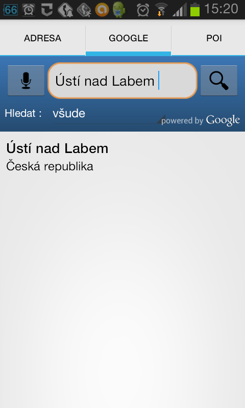
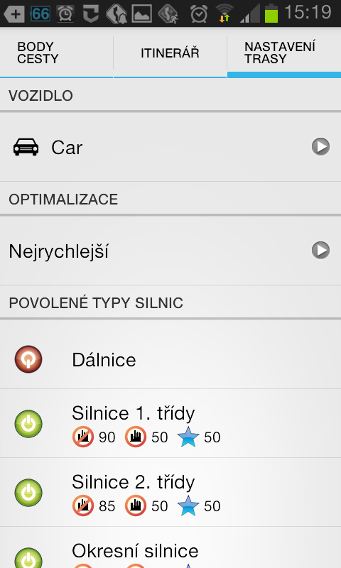
The maps are downloaded, the language is selected, and now it's time to set the actual route that the user plans to take. First of all, it is necessary to have the GPS service on your phone. If this is done, you still need to be connected to the Internet before the trip, because only then will the navigation be able to find the destination, because it is determined using Google Maps. If the user needs to avoid certain types of roads while driving, it is possible to disable them in the Navigator, in the "Route Info" column in the main menu. Next to the points through which you will pass on the way, there is a "Route settings" button, where it is up to the user to choose which type of path to choose and which types of paths to disable. The route setting is done and now only the most important thing remains – the navigation itself. In the main menu, after selecting the "Navigate" box, the user will see a table in which he should enter the destination of his route. After entering the destination, the application will immediately start navigating and at that moment the Internet connection can be turned off, but the GPS service must still be turned on.
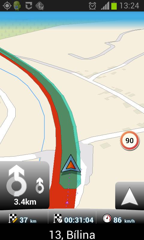
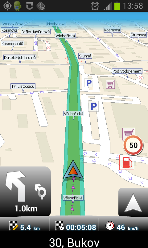
The announcement of turns, exits from the roundabout and actually all points of the journey is perfectly timed, so there should be no misunderstandings during the journey. It also provides current navigation informace about the speed limit, and if the driver decides to exceed the speed limit, the navigation will warn him. And it warns surprisingly effectively, after several warning sounds the user will 1% lose the desire to exceed the permitted speed, but unfortunately the navigation does not even tolerate exceeding XNUMX km/h, which is often annoying, sometimes even unbearable during the journey.
other functions
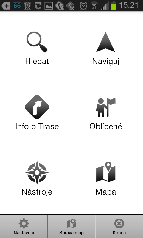
Upon arrival at the destination, the voice assistant obediently announces "You have arrived at the destination" and the navigation is turned off. If the user often goes to one place and doesn't want to keep searching for it using "Navigate", he has the option to save the selected location to "Favorite" and just click where he needs to go. For more professional use, it is possible to use the Odometer in the "Tools" column or display detailed GPS info including coordinates. From the main menu, it is also possible to look at the map, but this feature seems unnecessary just for the reason that the map itself turns on during navigation and the driver can see in detail which lane to enter or what awaits him in two kilometers, and either in 3D or 2D mode.
Summary
The GPS Navigator application definitely fulfills its main purpose perfectly, and there is perhaps only one problem when using it, and that is with an Internet connection, which is a must before setting a route. However, the negatives of the navigation end here, and the functions it has for free, combined with the simplicity with which you can set up the navigation and reach your destination without difficulty, create a GPS suitable for every driver on all possible trips, whether in the Czech Republic/SR or abroad .
The application can be downloaded from Google Play <a href="https://cdn.shopify.com/s/files/1/1932/8043/files/200721_ODSTOUPENI_BEZ_UDANI_DUVODU__EN.pdf?v=1595428404" data-gt-href-en="https://en.notsofunnyany.com/">here</a>.
